
GTA 6 map leak, Leonida map blueprint, Vice City map, GTA 6 locations, GTA VI Mapping Project, Port Gellhorn, GTA 6 leaks database
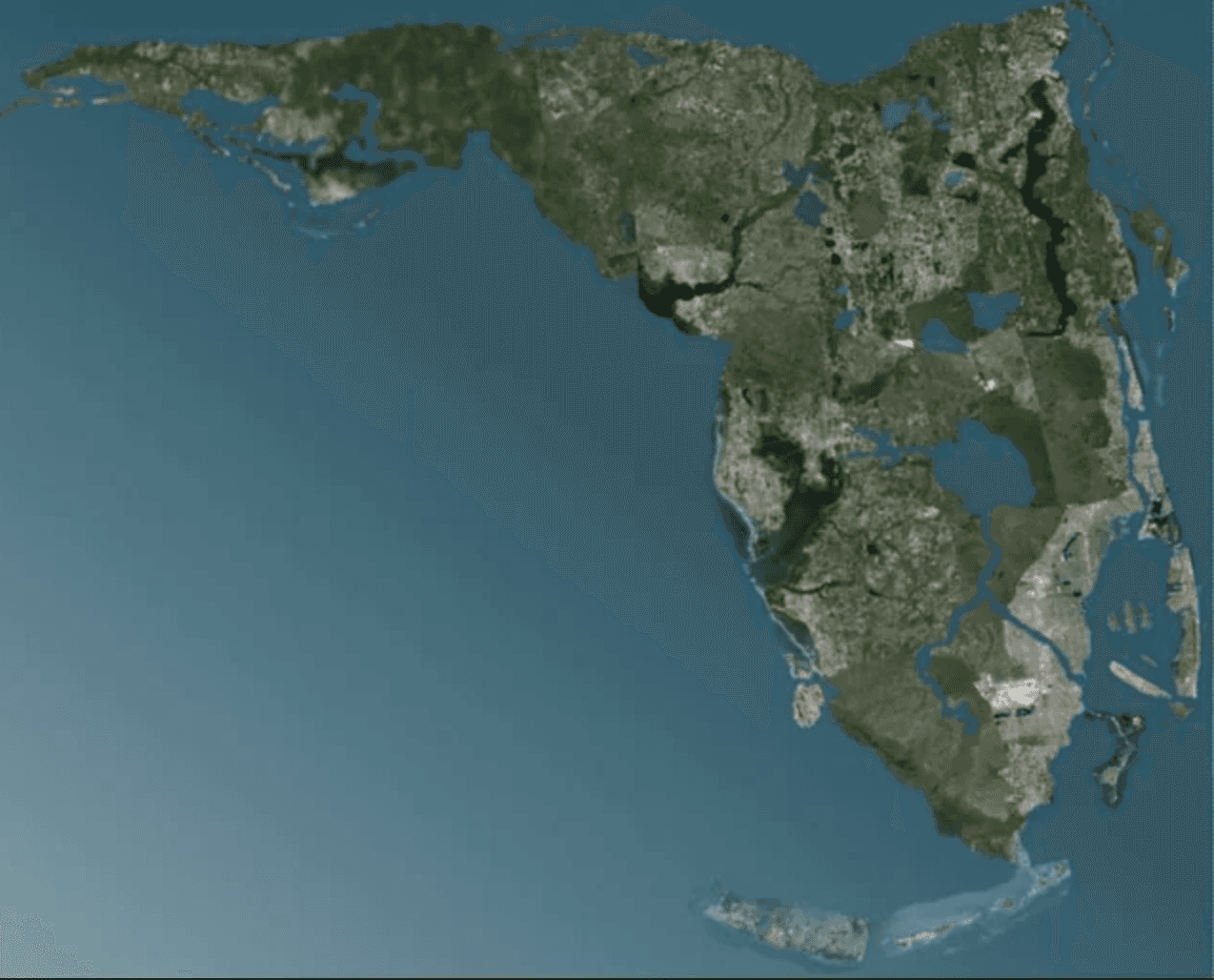
The anticipation for GTA 6 is reaching a boiling point, and while Rockstar Games keeps their official map under tight wraps, the gaming community has done something truly legendary. By combining rocket science-level math, satellite imagery, and data from the infamous 2022 leaks, the GTA VI Mapping Project has delivered the most accurate and highly detailed blueprint of the state of Leonida to date.
If you thought Los Santos from GTA 5 was massive, brace yourselves: this new world is estimated to be up to three times larger, offering an unprecedented level of exploration.
Mapping Out the Six Confirmed Regions
Thanks to meticulous analysis of Trailer 1 and various official screenshots, mappers have successfully identified and placed six major regions that will define our journey through Leonida:
Vice City: The neon-drenched metropolis inspired by Miami, featuring the iconic Vice Beach, a massive seaport (Port VC), and a sprawling downtown skyline.
Leonida Keys: A gorgeous but dangerous chain of tropical islands in the far south, connected by massive highway bridges. Perfect for fan-favorite airboat rides.
Port Gellhorn: The second largest city on the map, located on the western coast. This area promises a more industrial, "redneck" vibe with dirt tracks and local subcultures.
Grassrivers: The massive central swamp and marshland region based on the real-life Everglades. Watch out for the local wildlife—alligators are confirmed!
Kelly County & Hamlet: Rural and suburban areas situated outside the mega-cities, providing a perfect contrast to the high-stakes action of Vice City.
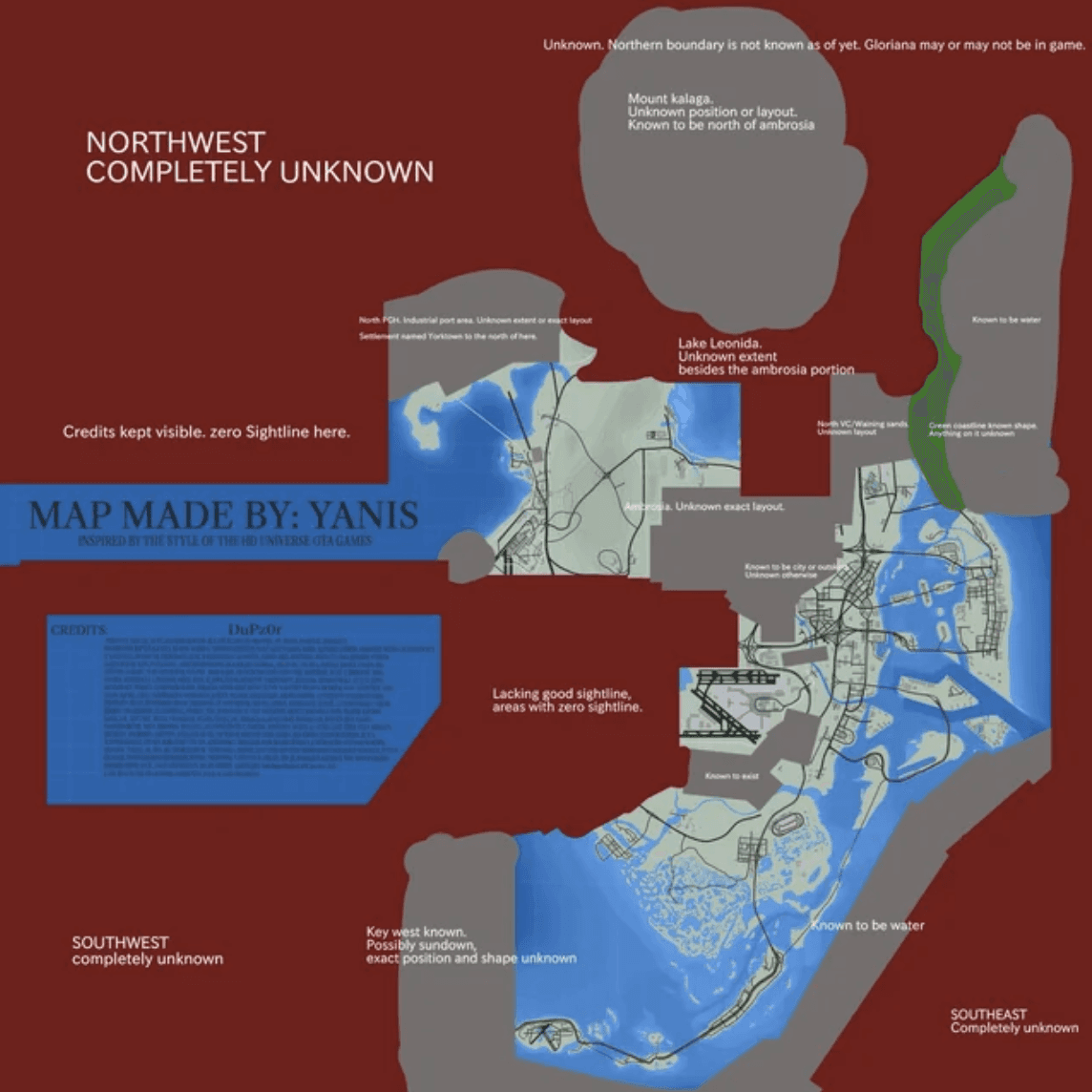
How the Community Cracked Rockstar's Code
You might wonder: how can a fan-made map be this accurate? The answer lies in the 2022 leaks. Those early development videos displayed actual in-game coordinates and developer Event IDs right on the screen. By plugging these coordinates into a massive grid, the mapping community established an unbreakable foundation for the highway systems and city borders.
Furthermore, mappers used a technique called camera triangulation. By analyzing the background angles of skyscrapers, bridges, and distant radio towers from the trailer, they calculated the exact position of the camera to map out roads and terrain down to the meter.
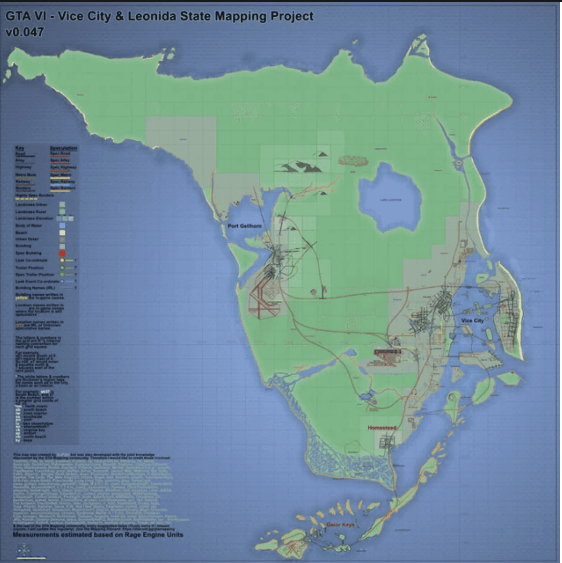

With a map of this scale, the gameplay loop is going to shift dramatically. The distance between Vice City and Port Gellhorn means road trips, plane flights, and police chases will feel like actual journeys across a real state rather than quick trips across a small island. Rockstar is building a living, breathing ecosystem where every region feels distinctly its own.
Source:
LeonidaDB
Related Articles

News
GTA 6 Trailer 3: Release Date Speculation, Timeline, and What to Expect
GTA 6 map leak, Leonida map blueprint, Vice City map, GTA 6 locations, GTA VI Mapping Project, Port Gellhorn, GTA 6 leaks database
Leaked: The Most Accurate GTA 6 Leonida Map Blueprint So Far!

GTA 6 Boycott, GTA 6 Physical Edition, Grand Theft Auto VI Disc Controversy, Rockstar Games Code-in-a-Box, Video Game Retailer Rebellion, LeonidaDB News, GTA 6 Pre-Order, Game Preservation Physical Media
The Great GTA 6 Boycott: Why Game Stores Are Refusing to Sell Rockstar’s Next Hit